Discover when, where, and how we collect 360 imagery
Meet Google's colorful Street View fleet and learn how we collect 360 imagery to power the world map.
Sources of photography

Where we are mapping this month
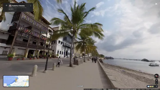
We drive and trek around the world to bring you imagery that enhances your experience and helps you discover the world around you. If you want to wave at our team, check out below when they'll be coming to a location near you.
../../streetview/static/feed/driving/data.json
| Date | District |
|---|
Because of factors outside our control (weather, road closures, etc), it is always possible that our cars may not be operating, or that slight changes may occur. Please also be aware that where the list specifies a particular city, this may include smaller cities and towns that are within driving distance.
A fleet prepared to uncover the world's wonders
We've visited incredible places on all seven continents and there is more to come. Before we hit the road, we consider many factors including the terrain, climate conditions, and population density to deploy just the right fleet and collect the best imagery.
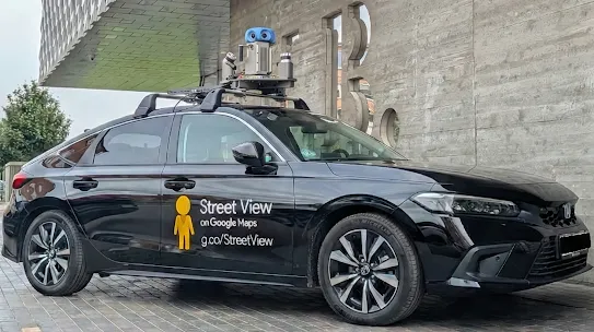
Street View car
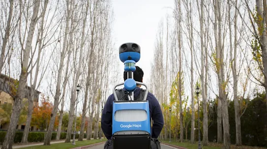
Trekker
Bringing maps to life
Collecting imagery
First off we need to actually drive around and photograph the locations to show in Street View. We pay close attention to many factors, including the weather and the population density of various areas, to determine when and where we can collect the best possible imagery.
Aligning imagery
To match each image to its geographic location on the map, we combine signals from sensors on the car that measure GPS, speed and direction. This helps us reconstruct the car’s exact route, and even tilt and realign images as needed.
Turning photos into 360 photos
To avoid gaps in the 360 photos, adjacent cameras take slightly overlapping pictures, and then we ‘stitch’ the photos together into a single 360 degree image. We then apply special image processing algorithms to lessen ‘seams’ and create smooth transitions.
Showing you the right image
How quickly the car's lasers reflect off surfaces tells us how far a building or an object is, and helps us build a 3D model of the world. When you move to an area in the distance in Street View, this model determines the best panorama to show you for that location.
Powering new AI experiences
The processed Street View data is also used as training and input data for Google's most advanced generative AI models, like Gemini, Nano Banana, and Veo. This helps generate new, synthetic images for a wide range of consumer and commercial uses that benefit from a deep understanding of the world. Before these generative uses, we apply our industry-leading privacy protections, including blurring and AI removal of people and vehicles in the imagery, to ensure that our AI development aligns with Google’s responsible AI development principles.