Recently Viewed ›
Recently Downloaded 
Close x
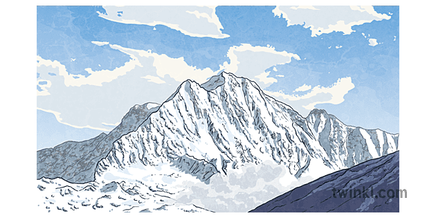
The Himalayas are a long range of mountains stretching for about 2500 km. The mountains found there are the highest mountains on Earth. It is home to nine out of the ten highest peaks in the world, including Mount Everest (8849 m), K2 (8611 m) and Kanchenjunga (8586 m).
The famous mountain range features lots of steep peaks and many glaciers. Unsurprisingly, the name ‘Himalaya’ means ‘home of snow’.
This name is very appropriate because many of the mountain peaks actually rise above the permanent snow line, meaning the snow never melts, even in summer!
Running from north to south, the Himalayas are made up of four main mountain belts known as the Tethys, the Great Himalaya Range, the Lower Himalayas and the Sub-Himalayas.
The Himalayas are in Asia. They cover areas of land in India, China, Tibet, Pakistan, Nepal and Bhutan.
The Himalayas began to form between 40 and 50 million years ago. Sounds like a long time ago, right? Well, actually, the Himalayas are one of the youngest mountain ranges in the world.
How did the Himalayas form?
The Himalayas formed when two tectonic plates, the Indian Plate and Eurasian Plate, collided with one another. The rock on the seabed was pushed upwards, forming the mountains that can be seen today.
Fun fact: the mountains in the Himalayas are actually still growing! This is because the Indian tectonic plate is still sliding underneath the Eurasian plate. As a result, the mountains are getting higher at a rate of 6.1 cm per year!
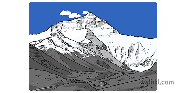
Mount Everest is the highest mountain above sea level, making it the highest point in the world. Its peak stands at a height of 8849 metres above sea level.
This means that the summit of Mount Everest is above the permanent snow line. The temperature never rises above 0˚C and in winter, the average temperature can fall to -36˚C.
The air pressure up there is very low, meaning there is little oxygen in the air. Winds can also reach 285 km per hour. Despite these inhospitable conditions, over 800 climbers risk their lives trying to reach the summit each year.
Fun fact: the Tibetan name for Mount Everest is Chomolungma, which means ‘Mother Goddess of the World.’
K2 is the world’s second highest mountain, standing at 8611 m above sea level.
The mountain was discovered in 1856 and given the name K2 because it was the second peak to be measured in the Karakoram Range.
K2 is one of the deadliest mountains to climb, and many climbers die attempting to reach its summit. In 1954, Italian climbers Lino Lacedelli and Achille Compagnoni became the first climbers to make a successful ascent to the top.
Kanchenjunga is in the eastern Himalayas and forms part of the Great Himalaya Range. It is the third highest mountain in the world and its summit stands at 8586 m above sea level.
It is considered a dangerous and difficult mountain to climb. However, in 1998, the British climber, Ginette Harrison, became the first woman to reach the summit.
Looking for fun ways to teach kids about mountain ranges? Check out some of our lovely teaching resources that cover the topics mentioned in this wiki, to spruce up your lessons and engage young learners.
Below are just a selection of the kinds of learning materials you can add to your arsenal. So, take the stress out of lesson planning and download the following resources:
Life on the Mountain KS2 Writing Activity
Tectonic Plates PowerPoint Presentation
Mountain Ranges of the World Display Poster
All Twinkl resources are teacher-made and designed by our talented team of designers! That means anything you download will be super useful, reliable and engaging. Perfect for supporting your teaching on a huge range of topics.
To get started, simply click ‘Download Now’ and this lovely resource will be saved straight onto your device. Then, you can use it however you like! Not yet subscribed? Click here to learn more.
 Home
Home  Membership
  Customer Support
  Create
  Blog
Blog 


