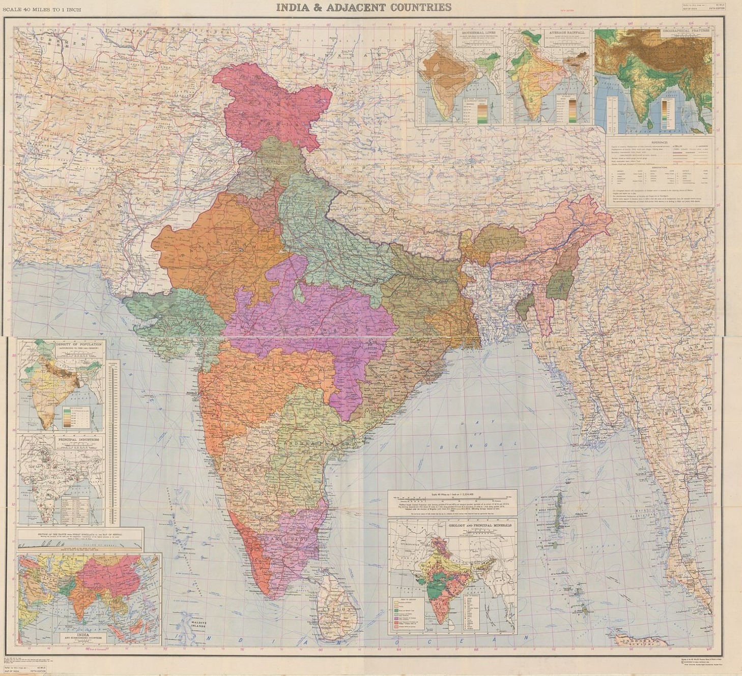
India & Adjacent Countries. Scale 40 Miles to 1 Inch. Fifth Edition.
SURVEY OF INDIA.
From Robert Frew Ltd. ABA ILAB, London, United Kingdom
AbeBooks Seller Since March 31, 1998
Quantity: 1From Robert Frew Ltd. ABA ILAB, London, United Kingdom
AbeBooks Seller Since March 31, 1998
Quantity: 1About this Item
Extremely large colour-printed folding map of India and the adjacent countries (82 x 173 cm) mounted onto linen with seven inset maps showing Density of Population, Principal Industries, Geology and Principal Minerals, Orographical Features, Average Rainfall, Isothermal Lines, and a small version of India and Surrounding Countries. Remnants of original paper wrappers printed in red still present to verso. Light spotting to verso only, generally a very good copy of this large-scale map. First published in 1951. Seller Inventory # 59553
Bibliographic Details
Title: India & Adjacent Countries. Scale 40 Miles ...
Publisher: Printed at the 101 H.L.O. Printing Group of Survey of India .
Publication Date: 1969
Binding: Soft cover
Store Description
All items are offered subject to prior sale. Our books are listed in British
Pounds and any exchange rate information on this site is for guidance only:
credit cards will be billed in pounds. We are happy to accept payment by Visa,
Mastercard or Amex, and ship expertly to anywhere in the world. Cheques should
be made payable to Robert Frew Ltd. in pounds sterling. Payment can also be made
in US dollars. Please advise us so that we can invoice accordingly. Any order
made from this site is subject...
Orders are usually shipped within 2 business days. Shipping costs are based on books weighing 2.2 LB, or 1 KG. If your book order is heavy or oversized, we may contact you to let you know extra shipping is required.
Payment Methods
accepted by seller
Check Money Order Cash Invoice Bank Draft Bank/Wire Transfer