
Share

Scan the QR code and open PeakVisor on your phone
Scan the QR code and open PeakVisor on your phone
A true trekker’s paradise and home to the roof of the world, Nepal is a spectacularly diverse country that’s home to some of the most beautiful mountain landscapes on the planet. Nepal contains 866 named mountains, the highest and most prominent of which is Mount Everest (Sagarmāthā/Chomolungma), which at 8,848 meters (29,029 feet) in elevation, is the world’s tallest mountain.

The country of Nepal is located in the heart of south-central Asia. It is a land dominated by the lofty peaks of the high Himalaya to the north that gradually give way to the low-lying plains of the Terai to the south.
Encompassing some 147,516 square kilometers (56,956 square miles), Nepal is the 93rd largest country on Earth. This makes it slightly smaller than Suriname, Tunisia, and Bangladesh but slightly larger than Nicaragua, Greece, and Tajikistan.
At the same time, Nepal is the world’s 49th most populous country as of 2021, which makes it the 50th most densely populated. Interestingly, Nepal is one of the most ethnically diverse countries in the world with dozens of different ethnic groups calling the region home.
Despite being somewhat rectangular in shape, Nepal shares its borders with only two countries. Indeed, it is located to the south of China (Tibet) and it is elsewhere surrounded by India. In particular, it is located to the east of the state of Uttarakhand in India, to the north of the states of Uttar Pradesh and Bihar in India, and to the west of the states of Sikkim and West Bengal in India, which separate Nepal from nearby Bhutan and Bangladesh.

These days, Nepal is officially divided up into seven provinces. However, these provinces are new as of 2015 when the country adopted a new constitution. Before the adoption of the 2015 constitution, Nepal was divided into five development regions. Nevertheless, as this change happened relatively recently, many people still refer to the development regions in day-to-day communications.
Within each province, the area is divided up into anywhere from nine to fourteen districts. These districts are then further divided into urban and rural municipalities. Here’s a quick overview of each of the provinces and the amazing landscapes that they contain:
Nepal’s easternmost provinces, Province No. 1 (प्रदेश नं. १) contains about 17% of the country's total land area. This province, which was part of the former Eastern Development Region, contains the bulk of Nepal’s highest mountains, including Mount Everest and Kanchenjunga.
Province No. 1 is divided into 14 districts, including:

Since Province No. 1 is home to some of Nepal’s highest peaks, it is also a superb trekking destination. Some of the most popular hiking and outdoor recreation destinations in the region include:

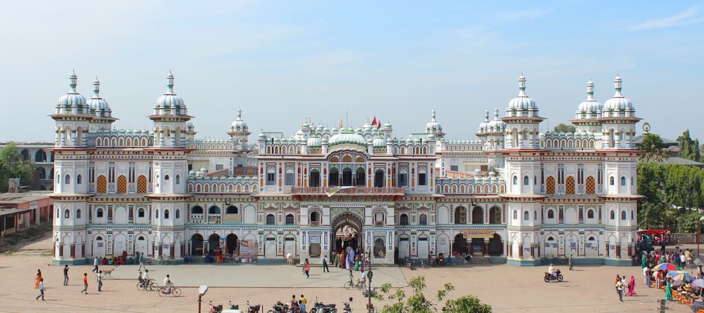
Stretching along the southeastern edge of Nepal, Province No. 2 (प्रदेश नं० २) is the smallest province in the country by area, though its second largest by population. It was a part of both the former Eastern Development Region and Central Development Region and it now has 8 districts, including:

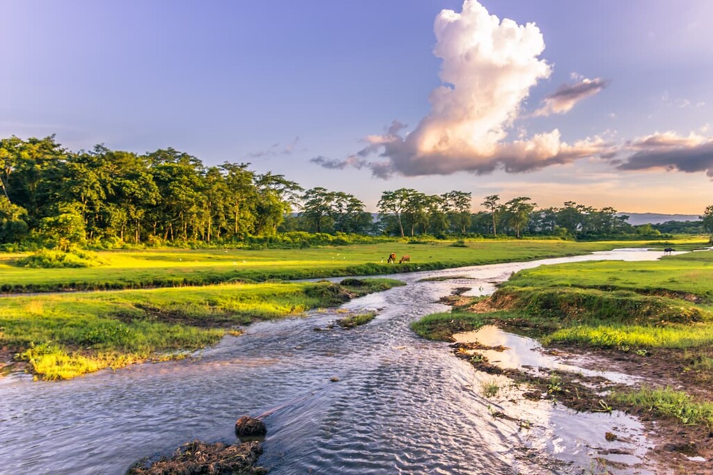
Unlike most of Nepal, Province No. 2 is dominated by mostly flat landscapes. Indeed, it is situated mostly along the Terai plains that separate southern Nepal from the northern part of the Indian state of Bihar.
Nevertheless, the province does have a large wildlife reserve—Koshi Tappu Wildlife Reserve (कोशी टप्पु वन्यजन्तु आरक्ष)—that protects a sizable area of wetlands in the eastern part of the province. It is also home to the country’s last remaining herd of Asiatic buffalo.
Formerly part of the Central Development Region, the province of Bagmati is located in the east-central part of Nepal. It is the most populous province in the country due to the fact that it contains Nepal’s capital, Kathmandu.
Within Bagmati Province, there are 13 districts:

Additionally, even though the province is quite urbanized in areas, there are still plenty of stunning national parks in the region to check out. This includes:

As the country’s most populous province, Bagmati is also an area of rich cultural diversity with many ethnic groups, including Tamang, Bahun, Chhetris, Newars, Magar, Kami, and Gurung being some of the largest groups in the province. Furthermore, there are many important cultural sites in the province, including Durbar Square.
Gandaki Province, which was formerly part of the Western Development Region, is located in north-central Nepal. The province contains 11 districts, including:

Gandaki Province is one of the most mountainous areas of the country, after Province No. 1. In particular, it contains both the Annapurna Conservation Area (अन्नपूर्णा संरक्षण क्षेत्र) and the Manaslu Conservation Area (मनास्लु संरक्षण क्षेत्र), which makes it a superb trekking area.
The province is also home to the city of Pokhara, which is one of Nepal’s major metropolitan regions outside of the Kathmandu Valley.
The second of Nepal’s two mostly low-lying provinces, Lumbini is a province that’s situated along the southwestern border of the country. It was formerly part of the Western and Mid-Western Development Regions and it now contains 12 districts:

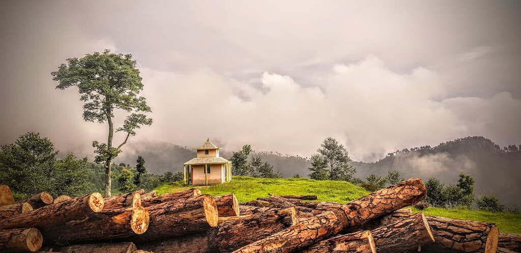
The northern part of Lumbini province is dominated by rolling hills that eventually give way to the Indo-Gangetic Plains to the south. Technically, the province contains a small section of the high Himalaya, but it is mostly home to the Middle Mountains and the Terai plains. Within the province there are a handful of parks and conservation areas, including:

Karnali Province, which was formerly part of the Mid-Western and Far Western Development Regions, is the largest province in Nepal by area. However, it is also the country’s least populous province.
Karnali contains 10 districts, including:

The province is dominated by the peaks of the high Himalaya to the north and the Middle Mountains to the south. Although much of the region is mountainous, the arable land in the province is mostly used for agriculture, which is the leading industry in Karnali.
There are also two national parks in the province, Rara National Park (रारा राष्ट्रिय निकुञ्ज) and Shey Phoksundo National Park (शे-फोक्सुण्डो राष्ट्रिय निकुञ्ज), which are well worth a visit if you’re looking to get off the beaten path.
Nepal’s westernmost province, Sudurpaschim is located along the country’s western border with both Tibet (China) and India. It was formerly part of the Far Western Development Region and it now has 9 districts:

Sudurpaschim is very mountainous, particularly in the northern part of the province. However, the southern quarter of the province is located along the very flat Terai plain. Due to its distance from Kathmandu, Sudurpaschim isn’t visited as frequently by international tourists as some of the more eastern provinces. However, there are a number of parks and conservation areas in the province, including:

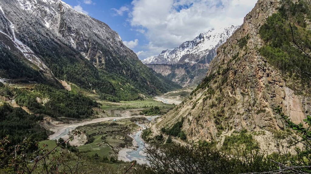
Although Nepal is best known for its towering Himalayan peaks, the country is actually home to a diversity of geographical features and geologic zones. While one could technically divide the country into five geologic zones, the two most notable are the Himalaya and the Terai.
Out of all the countries in the world, the mountains of Nepal need no introduction. Nepal is home to a substantial portion of the mighty Himalaya—the world’s tallest mountain range.
The Himalaya, which stretch across the entirety of Nepal and dominate the landscape in the northern third of the country, formed as the Indian plate collided with the Eurasian plate. Interestingly, the range is still rising to this day as the Indian plate continues to drift northward.

Furthermore, Nepal is home to eight of the world’s fourteen 8,000-meter peaks. These peaks, which are the tallest in the world, include:

In fact, the only 8,000-meter peaks that are not located at least partially in Nepal are:

All of these are located in Pakistan and/or China (Tibet), and some are located in the Karakoram rather than the Himalaya proper.
The Terai (तराइ), which is also part of the Indo-Gangetic Plain, is a lowland region that stretches across parts of northern India and southern Nepal.
Geologically, the Terai is crisscrossed by a number of major rivers, including the Kosi, Narayani, Sarda, and Karnali, each of which have their own massive alluvial fans. As a result, the region is dominated by alluvial deposits of sand, silt, and clay. In fact, the plain is believed to have a layer of sediment about 1,500 m (4,920 ft) thick that’s built up over the centuries.
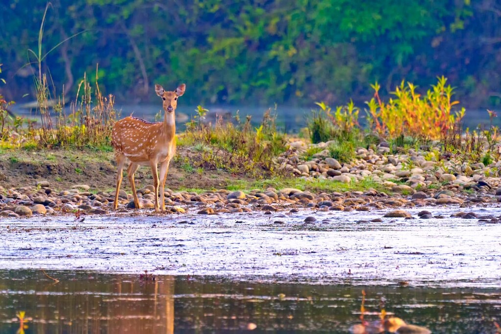
Nepal is a spectacularly biodiverse country. It can roughly be divided up into three ecological zones, including the high Himalaya, the Middle Mountains, and the Terai.
Within the country, the climatic conditions vary dramatically from the frigid conditions of the high Himalaya to the sweltering heat of the Terai lowlands. As a result of this varied climate, the country contains thousands of plant and animal species.

In particular, Nepal is home to a superb collection of wild cats, including Bengal tiger, clouded leopard, Indian leopard, snow leopard, Rusty-spotted cat, leopard cat, fishing cat, Eurasian lynx, Pallas’s cat, and the Asian golden cat.
It is also home to notable animals like the golden jackal, Asian palm civet, binturong, red panda, Himalayan wolf, dhole, and the Bengal fox. Furthermore, there are a number of bear species that roam the country, including the sloth bear, Asiatic black bear, and the critically endangered Himalayan brown bear.
Primates are also particularly abundant in the southern part of the country, including Assam macaque, rhesus macaque, Tarai gray langur, and the Nepal gray langur.
Finally, Nepal contains a small population of Asian elephants, which are critically endangered. There are also a number of ungulates in the country, including the endangered wild water buffalo, the Himalayan tahr, the argali, and the wild yak.
The land that is now part of the country of nepal has been inhabited for thousands of years. However, much of Nepal’s earliest history is that of many competing kingdoms as the concept of a unified Nepal is relatively new.

The earliest rulers of the bulk of the land that is now Nepal were the Gopalas and the Mahishapalas, which ruled the Kathmandu Valley and the surrounding area until the seventh or eighth century BCE when the Kirantis took control of the region. In around the year 300 CE, the Lichhavis people settled in the region, outsing the Kirantis in the process.
The Lichhavis ruled the region until about the year 1200, when the Mallas gained control During their nearly six century long rule, the Mallas established a number of major temples in Nepal. However, after the fall of the Mallas, the region was split up into three distinct kingdoms—Kathmandu, Bhaktapur, and Patan—while the rest of the country was divided into 46 principalities.
By the late eighteenth century, King Prithvi Narayan Shah of the Gorkha Kingdom conquered much of the country and defeated the warring kingdoms. He then ruled over a newly unified Nepal, leading to the unification of the country that exists to this day.
The Shah dynasty continued for over 200 years, however, the country underwent many changes in the process. By the mid-nineteenth century, Nepal saw the establishment of its first prime minister. During this time, when India was ruled by the British, Nepal was a closed kingdom that was isolated from its neighbors, thus minimizing the influence of the British on the country.
However, the role of the prime minister of Nepal quickly became a hereditary position that was held by members of the Ranas family. In the 1950s, the Ranas were overthrown and the country established a democratic governance.
By 1959, King Tribhuvan was reinstated as Nepal’s head of state as the former prime ministers had usurped this power. This led to the establishment of a new Nepal constitution and the first democratically held elections in the country.
In the 1990s, the country entered a period of Civil War, during which time the vast majority of the Nepalese Royal Family also died in a mass shooting at the hands of Crown Prince Dipendra. Not long after, in 2008, the monarchy of Nepal was officially abolished and the country became a federal democratic republic with a democratically elected head of state and a constitutionally elected Prime Minister as the head of the government.

Arguably the most significant event in Nepal during the 2010s was the 2015 earthquake, which killed more than 9,000 people in the country, making it one of the worst-ever natural disasters in the region. This earthquake destroyed many of the country’s important cultural sites and caused an avalanche on Mount Everest that killed 22 people. The country is still slowly but surely recovering from the disaster.
The gorgeous mountains of Nepal have long been a source of intrigue for climbers. However, due to the fact that Nepal was a closed kingdom until the 1950s, mountaineering in the country by people other than Nepali citizens did not start until relatively late in the history of Himalayan climbing.
Indeed, the earliest Himalayan climbing expeditions ventured solely into the Indian Himalaya or the Tibetan Himalaya. The early Mount Everest expeditions, including those of George Mallory, attempted to climb the mountain from the north as they could not get permission to enter Nepal.

However, not long after Nepal opened for foreign visitors, French climbers made the first ascent of Annapurna in 1950 and a team of British, New Zealand, and Nepali climbers made the first ascent of Mount Everest in 1953. These two climbs spurred what is now called the Golden Age of Himalayan Mountaineering, which continued until all fourteen of the world’s 8,000-meter peaks had been climbed in 1964.
Since then, Nepal has become a popular tourist destination for both mountaineers and trekkers. The popularity of the country among adventurous tourists has led to some difficulties, however, particularly when it comes to overcrowding in popular trekking regions and on the summits of the world’s highest peaks. Nevertheless, any climbing or trekking trip to stunning Nepal is sure to be a journey of a lifetime.

There are no ifs, ands, or buts about it: Nepal is a world-class trekking destination. Whether you’re looking for a short jaunt into the mountains or an epic trekking adventure, here are some of the best places to check out in the country:
The Annapurna Conservation Area ((अन्नपूर्ण संरक्षण क्षेत्र) is Nepal’s most popular trekking region. The park is located in the north-central part of the country, just outside the city of Pokhara.
As a conservation area, rather than a national park, the region allows for traditional land uses. Indeed, visitors to the Annapurna Conservation Area will normally stay in local communities, such as Ghandruk, Ghorepani, and Chomrong, for the night during their travels.

Within the Annapurna Conservation Area, the Annapurna Base Camp Trek, the Annapurna Circuit Trek, and the Ghorepani-Poon Hill Trek are easily the most popular hiking options. But, there’s truly something for everyone to love in the region.
Home to the roof of the world—Mount Everest—Sagarmāthā National Park (सगरमाथा राष्ट्रिय निकुञ्ज) is Nepal’s first national park. Sagarmāthā is located in the northwestern part of Province No. 1 within the Solukhumbu District.
The park shares a border with Tibet’s Qomolangma National Nature Preserve and the nearby Makalu Barun National Park. After the Annapurna Conservation Area, it is one of the most popular tourist destinations in the country.
While many visitors to the park trek to Everest Basecamp, there are plenty of trekking opportunities to be had in the region. This includes the Three Passes Trek, which is often considered to be one of the hardest treks in the country.

If you’re looking to get slightly off the beaten path, the Manaslu Conservation Area is a sure bet. This beautiful conservation area is located in north-central Nepal and is situated around its namesake peak, Manaslu.
When compared to the Annapurna and Everest regions, the Manaslu region sees just a fraction of international visitors. However, the Manaslu Circuit is a 16 to 18 day trek that’s well worth the visit if you’re interested in gorgeous scenery and fantastic cultural sites.

Looking for a place to stay in Nepal? Here are some of the best cities in the country to check out on your next visit:
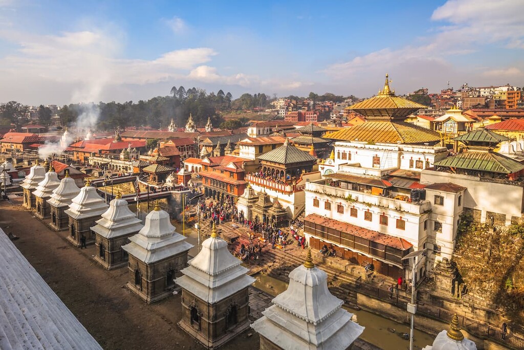
Nepal’s capital, Kathmandu is a bustling city of some 1 million people. Kathmandu is located in the heart of the country within the large, bowl-shaped Kathmandu Valley and it has long been a cultural and economic hub for the region.
Due to the fact that Kathmandu has the country’s largest airport, it is the main starting point for most international tourists to Nepal. Furthermore, Kathmandu has many important cultural sites that are well worth visiting, such as the Pashupatinath temple and the Boudhanath stupa.

The second largest city in Nepal, Pokhara is a community of some 525,000 people that live in the north-central part of the country. Pokhara is often considered to be one of the country’s tourism centers because it is the best place to start a trip into the Annapurna Conservation Area.
Pokhara is just a short flight away from Kathmandu and it is a worthy destination in its own right. The city contains many superb restaurants as well as some stunning scenery thanks to the nearby Phewa Lake.

Nepal’s third largest city, Lalitpur is located in the southern part of the Kathmandu Valley, just outside of the city of Kathmandu. Lalitpur is home to about 230,000 people and it is known for its fantastic cultural sites.
In particular, Lalitpur is known for being the home of Patan Durbar Square, which is a UNESCO World Heritage Site that was once the royal palace of the Malla Kings. Although the city was badly damaged during the 2015 earthquake, it is in the process of rebuilding.

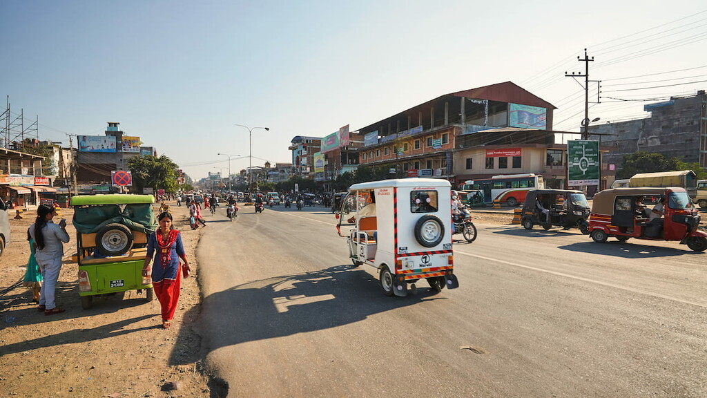
Bharatpur is home to about 280,000 people who live in the central part of the country. It is located along the banks of the Narayani River and it is one of the country’s fastest-growing cities.
Bharatpur is an agricultural city, though it is quickly becoming much more metropolitain. The city’s economy is transitioning more toward health services and education. It is also located close to Chitwan National Park, so it is Nepal’s third-largest tourist destination.

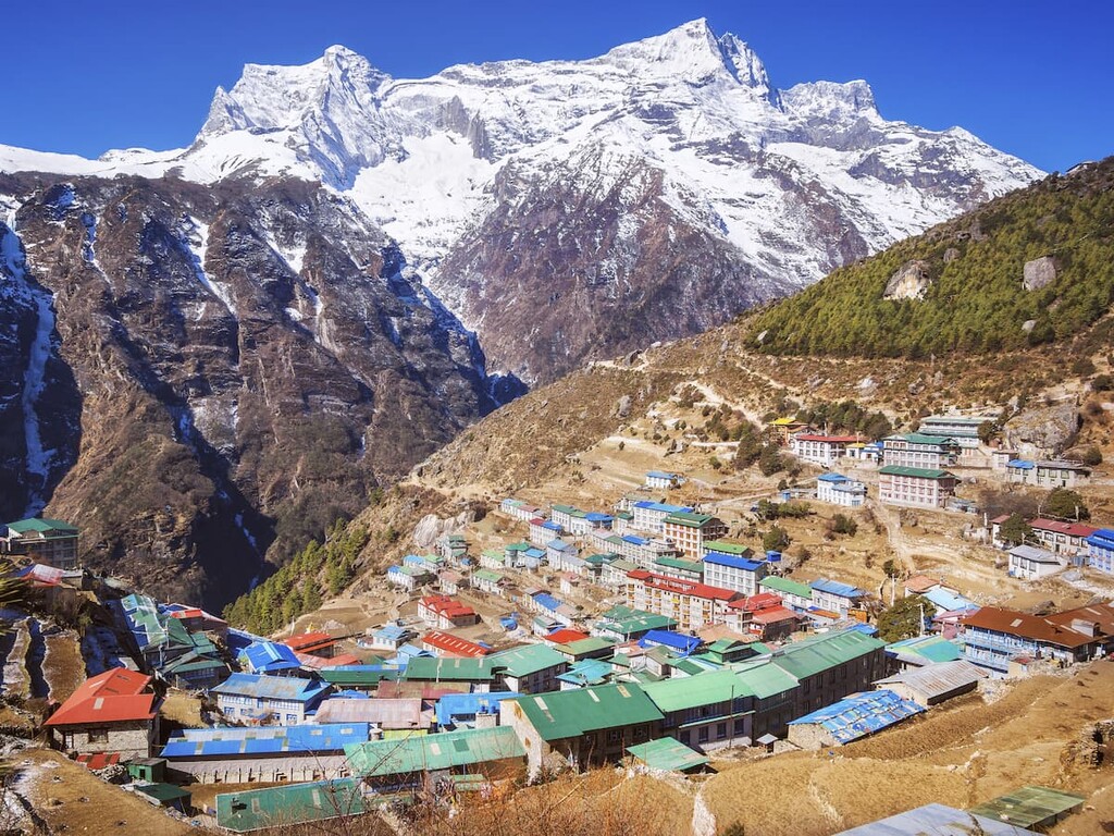
Although not quite as large as some of the other cities that we’ve discussed so far, Namche Bazaar is a household name among trekkers in the Himalaya. The small town of about 2,000 residents is located at an elevation of around 3,440 meters (11,286 ft) in Province No. 1 and it is a popular stopping point on my treks in the Khumbu region.
Namche Bazaar is also one of the main communities of ethnic Sherpa people in Nepal and it is considered to be the unofficial capital of the Khumbu. As of 2021, there are no motorable roads connecting Namche Bazaar to the main airport in the region at Lukla. Therefore, most people who venture to Namche Bazaar do so on foot, which is a journey that takes most people about two days.
If you are lucky enough to visit Namche Bazaar, do take the time to visit the Museum of Sherpa Life and the Sagarmatha National Park Visitor’s Center. It is also worth visiting the Namche Monastery and the weekly Namche market.


Explore Nepal with the PeakVisor 3D Map and identify its summits.
ultra
8000ers
china-ultras
nepal-ultras
ultra
8000ers
india-ultras
nepal-ultras
ultra
8000ers
china-ultras
nepal-ultras
ultra
8000ers
china-ultras
nepal-ultras
ultra
8000ers
china-ultras
nepal-ultras
ultra
8000ers
india-ultras
nepal-ultras
ultra
8000ers
china-ultras
nepal-ultras
ultra
8000ers
china-ultras
nepal-ultras

