Lynn Amber - Travel & Photography
sharing my thoughts through words and images
Big Bend National Park: The River

The River
Through canyons, past farms
Giving life to the desert
Behold, Rio Grande
The Rio Grande
At once forgiving,
And ever so nourishing
A friendly border.
Two poems – what a bargain! I’m not quite sure why I chose to start my three-part series about Big Bend with the river. It’s where we started our journey in the park this time, and so I’ll begin here. Three years ago, when I saw the Rio Grande River for the first time, I was extremely disappointed. I believe I even remarked, “That must be a creek that flows into the river. It can’t be the Rio Grande.” I’m not sure why I expected it to be a much larger river – maybe because of the name? I really anticipated something more the size of the mighty Mississippi. Funny how perceptions can be so misleading! It was barely a trickle in some places. You could literally wade across to Mexico in numerous places. That was in March of the year.
The Rio Grande has redeemed itself to me. We stayed in the park in January this time, and the river was much higher. Still not a large river but I was really smitten with it on this visit. Although the size of the river is deceiving, I came to realize just what a life-giving force this small water resource is to the surrounding area. It winds through canyons and flows slowly through flat, expansive valleys supporting a multitude of animal and plant life – and does this for close to 2000 miles, from its headwaters in Colorado to the Gulf of Mexico. About 120 miles of the Rio Grande define the southern park boundary, and the *bend* in the river here is what gives this park its name.
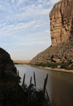
It was interesting for me to learn that upstream, many practices such as irrigation, agriculture, manufacturing and dams have led to a significant decline in the water level once it reaches Big Bend. Much of the water in the Rio Grande as it flows through Big Bend actually comes from Mexico’s Rio Conchos. So, we have much to owe Mexico for continuing to nourish the watershed. In fact, further down river at Amistad Reservoir, Mexico and the United States jointly manage this area.
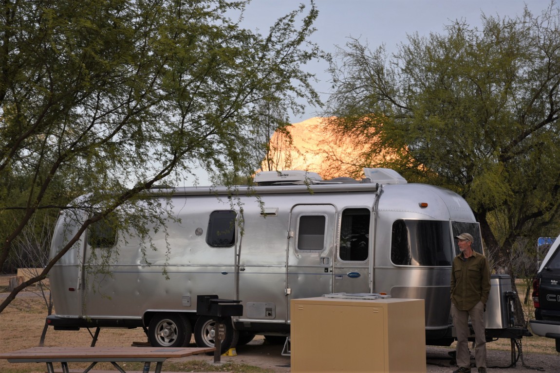
We arrived in Big Bend National Park about the time we usually reach our destinations – approaching dusk and without reservations. Par for the course! Big Bend has three established campgrounds – one in Rio Grande Village, one in the Chisos Mountains, and one at Castolon. The campground in Rio Grande Village was full, as was the campground in the Chisos (although our trailer is too long for that campground anyway). The sign at Panther Junction Visitor Center indicated that Cottonwood Campground at Castolon had some openings. The visitor center was closed so we had no way of knowing real-time current conditions.

Big Bend NP encompasses over 800,000 acres. It is almost 60 miles from one side of the park (Rio Grande Village) to the other side (Cottonwood Campground). At this point, we were at the Panther Junction Visitor Center (somewhat central) so we had at least 33 miles to go to reach Cottonwood CG – on a slow, and winding road. It was dark enough by the time we arrived in Cottonwood, that we had to park the Airstream and walk the loop looking for an open site. There were literally only 2 sites open and luckily, our 25’ trailer would fit in one of them. It was a tad tight backing in (especially in the dark) but we did it. We’ve gotten quite good at maneuvering in low light conditions! I’m not sure if I’m proud of that fact or not.

Cottonwood Campground was a pleasant surprise. The sites are spacious, and there is adequate distance between sites with plenty of trees (cottonwoods, of course!) interspersed. There are no hook-ups, and a potable water spigot exists (only one) but you are restricted to 5 gallons each per day. So, words of wisdom here, enter the park with a full fresh water tank! We did not. It’s the one time we have NOT filled our fresh water tank while traveling. We decided to only fill it 1/3 full to save on fuel thinking that we would just fill up in the park campground. The only place to fill up your fresh water tank directly is in Rio Grande Village on the far side of the park. It’s also good to have some portable water containers. We did not. That’s another wish list item that we have yet to purchase. We figured all the campgrounds would have fresh water fill-up available. Wrong! My fault entirely for not researching adequately. We scrounged several gallon containers from the camp host at Cottonwood that we used to replenish our fresh water tank when we were boon-docking there, and filled up once at Rio Grande Village before moving to dispersed camping. Live and learn 🙂

We spent two nights at Cottonwood. We wanted to visit Santa Elena Canyon once again, as we really liked that short hike the last time we visited. However, the Terlingua Creek that flows into the Rio Grande at the mouth of the canyon was high enough that you needed to wade across it to reach the trailhead. The creek is dry most of the year, so this was a surprise to us. We did not have our water sandals with us in the truck so we opted to play it safe and not risk wading across barefoot. The pictures posted above, therefore, are from our trip up the canyon three years ago!
DORGAN HOUSE TRAIL
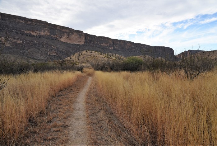
Love the grasses along this trail!!
On our way back to the campground from Santa Elena Canyon, we stopped off at the Dorgan House Trail. The interpretive signs along this trail gave a great history of the early ranching and farming industry that took place here, and outlined the importance of the river to these settlements. I started to see this tiny water resource in a new light.

Dorgan House Ruins
Around 1918, the Sublett family built an adobe house on the mesa along this trail and farmed the area. They grew several livestock crops including sorghum, corn, and alfalfa. Albert Dorgan, a business partner of Sublett, joined the settlement and built an impressive house above the Sublett site. The remains of this house are still standing – enough to give an idea of the structure. He had a commanding view of the floodplain where they farmed, and the river from this spot. The farm survived until the late 1930’s. I was surprised at the amount of farming done here in this very remote desert area. These surely were very hardy folks!


Leaving the trailhead and heading back to Cottonwood, we stopped at an overlook at sunset and I was able to capture Cerro Castellan in all its glory. I don’t think I could have planned this timing. I love it when these spontaneous photo opportunities happen! Right place at the right time…..

HOT SPRINGS CANYON TRAIL

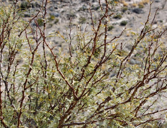
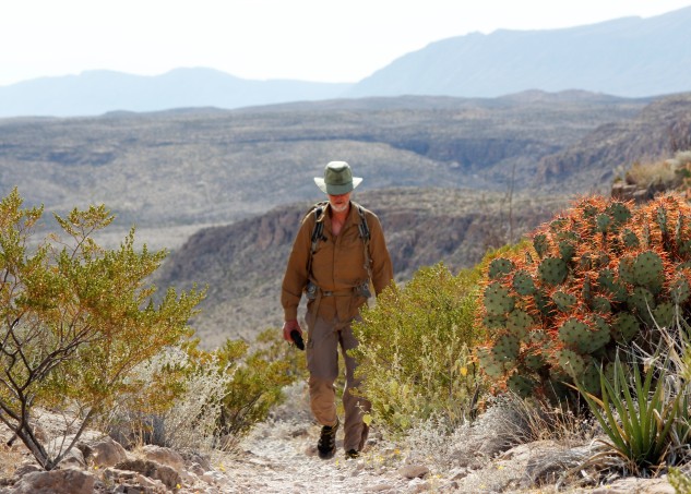
The trail that ascends from the Daniel’s Ranch area of the park was by far one of the nicest trails we encountered on this trip. The trail traverses high desert mesas above the river and the views of the Rio Grande River are impressive. I decided to focus on plant material during this hike and it ended up being a wise decision. The diversity of plants along this trail was amazing.


The trail ends at the historic Hot Springs settlement. You can opt to drive to the hot spring, but a dip in the hot spring after a 3-mile hike was much more rewarding!
On our last trip here, we toured the ruins of the old Hot Spring settlement and saw the ancient pictographs on the rock cliffs.


This time around we focused totally on plunging right into the warm springs!! We planned ahead and brought our swim suits with us for a dip in the hot spring. We found some thick cover along the river, changed into our suits and joined the 8 or so other folks enjoying the hot springs.

It was so much fun! We had some great conversations with our fellow travelers. Eventually, they all started to leave, and we found ourselves alone for a spell to enjoy the hot spring and the river. Heavenly!
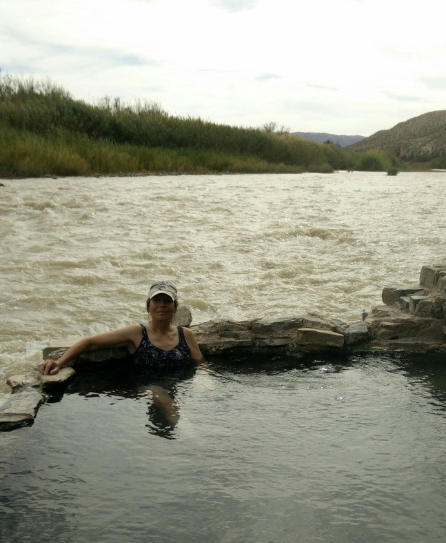

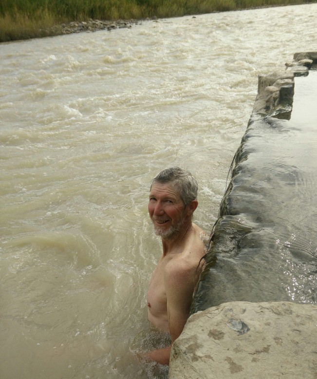
Since it was getting late in the afternoon, we could not linger too long. Reluctantly, we gathered up our belongings and headed back up the trail. We had a 3-mile hike back. I was too lazy to change back into my hiking gear, and with Jim’s encouragement, I made the return trip in my bathing suit to let the desert air dry me off. Luckily, we did not find too many other folks on the trail 🙂

The trail is around 6-miles round-trip with some elevation changes but I would consider it to be moderate in skill level. It is very exposed with little to no shade, so depending on the time of the year, it might be advisable to hike earlier in the day. In any case, bring plenty of water!


The views of the river are outstanding. Nowhere in the park can you see the lushness of the river valley, and the harshness of the dry desert landscape so dramatically.
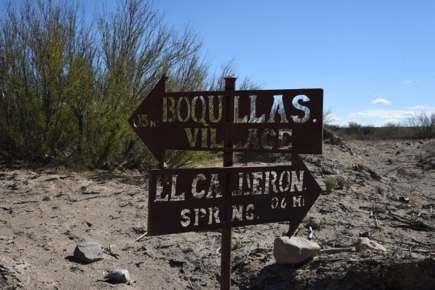
BOQUILLAS
We had not been planning on crossing the border while here, but events in our own country at the time were such that we felt obligated to visit our good neighbors to the south, and show our support for them. It’s a funky little border crossing! And very low-key.
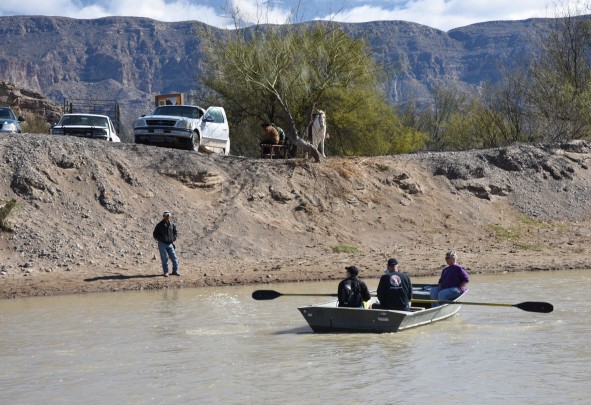
The small town of Boquillas is 160 miles from its nearest Mexican town. Population: 200 hundred people, and 200 hundred Chihuahuas! (this according to a local – I think it’s a joke! Although, there were a lot of dogs running around!) It’s an isolated community that depends in part on tourist trade from the United States. The closing of this small border crossing after 9/11 devastated this harmless little village. The border crossing was finally re-opened in 2013, and gives a few folks from the village some much needed extra income. It costs $5 each to be ferried across the river in a rowboat. I suppose when the river is low, you could opt to wade across but it’s not recommended. Once you reach the other side, the actual town is a ½ mile walk down a dirt road from the river. You can choose to walk, or you can elect to pay for a horse or donkey ride into town accompanied by a guide. The fee for a ride and a guide is between $5 – $8.

We chose to walk, and upon entering the town, reported to the customs office. Interestingly, there was no sign to indicate where the port of entry was housed. We had totally forgotten that we even needed to check in with anyone! One of the guides who had ushered another couple to the town gestured to us as we started walking down the street, and motioned us over to a trailer that was set up inside a tall chain-link fence. “You need to check in here,” he said. He was looking out for us, and we really appreciated that and thanked him immensely. So, be forewarned, when you enter the town and head up the hill – at the top of the hill on the right is a fenced off area with a white trailer. That’s the official port of entry. Report to the custom’s officer there 🙂

I had read that there were two decent restaurants in the small town, and I chose the one that claimed to have a view of the river – the Jose Falcon Restaurant. It was a good choice. They had an outside patio that was on the second floor and it did indeed give a view back towards the river. We enjoyed a bottle of cerveza each (well, okay, two bottles each actually), and some light Mexican food. I had a quesadilla, and Jim tested out the chicken burrito. The portions were small but adequate and good. We received unlimited refills of tortilla chips, and the dipping sauce that was served with the chips was *out of this world* good. The ingredients were simple – onions, jalapenos and shredded carrot. I asked the owner about it, and she said that it was her father’s recipe. Delicious!


We had the pleasure of chatting with the owners since the place was not busy. The restaurant is owned and operated by the daughter of the original owner. When the border crossing closed after 9/11, her father was forced to close the restaurant. The daughter and her husband were living in Atlanta, Georgia for a number of years, and she is a United States citizen. When the border re-opened, she decided to come back to the town where she grew up and re-open her father’s restaurant. Quite a story! They were such nice folks, and I’m glad we went to the trouble to cross the border and experience a little bit of their life and town.
I would recommend taking time to hike the Boquillas Canyon Trail on the U.S. side as well. The trailhead is beyond the road that leads to the border crossing. It’s a beautiful canyon carved through the cliffs of the Maderas del Carmen. The pictures below of this canyon are also from our previous trip to Big Bend.


What a fun day! We love hot springs. And yes you are a hottie 60 or not!
On Feb 11, 2017 11:46 PM, “Lynn’s Reverse Gap Year” wrote:
> lynnsreversegapyear posted: ” The River Through canyons, past farms Giving > life to the desert Behold, Rio Grande The Rio Grande At once forgiving, And > ever so nourishing A friendly border. Two poems – what a bargain! I’m not > quite sure why I chose to start my three-part ser” >
LikeLike
Ha! Thanks! We’ve been out if cell range for a few days so just catching up!
LikeLike
What a great write-up and photos. The wife & I travel by motorcycle (trike & trailer) and are headed to BBNP next Tuesday (soon as that storm line moves thru). Found your blog doing a google search for info on the Park. We, too plan to stay at Cottonwood CG, so was glad for the information. Guess we need to get there early in the day?
Thanks
LikeLike
Thanks! Yes, it’s always best to get there early in the day. I think their season is getting busier as spring approaches. I’ll be posting about our move to dispersed camping in the park and desert hiking in the next day or two. Have fun! We love Big Bend!
LikeLike