World map of Pangaea, Laurasia, Gondwana and sea Tetis — Vector
L
2000 × 1724JPG6.67 × 5.75" • 300 dpiStandard License
XL
4724 × 4072JPG15.75 × 13.57" • 300 dpiStandard License
VectorEPSScalable to any sizeStandard License
EL
VectorEPSScalable to any sizeExtended License
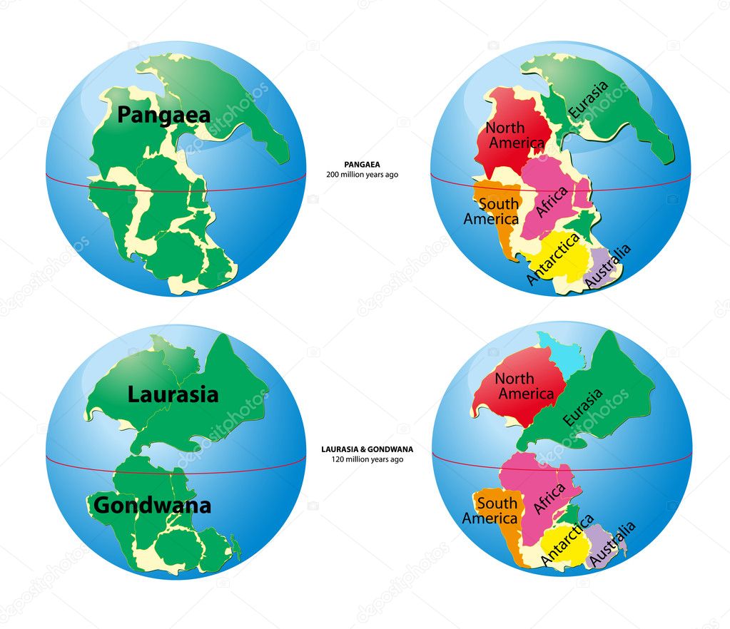
World map of Pangaea - 200 million years ago, Laurasia, Gondwana - 120 million years ago. Was the supercontinent that existed during the Paleozoic and Mesozoic eras, before the component continents were separated into their current configuration.
— Vector by edesignua- Authoredesignua

- 11326956
- Find Similar Images
- 5
Stock Vector Keywords:
- australia
- america
- and
- era
- time
- current
- geo
- their
- tectonics
- Africa
- existed
- worldmap
- super
- vector
- world
- atlas
- stratigraphy
- cartography
- europe
- history
- fingers
- laurasia
- separated
- was
- million
- sea
- ocean
- during
- maps
- continent
- earth
- the
- before
- gondwana
- lithosphere
- were
- of
- map
- cambrian
- component
- ago
- planet
- geology
- asia
- eras
- jurassic
- continents
- years
- tetis
- old
Same Series:


Similar Stock Videos:










Usage Information
You can use this royalty-free vector image "World map of Pangaea, Laurasia, Gondwana and sea Tetis" for personal and commercial purposes according to the Standard or Extended License. The Standard License covers most use cases, including advertising, UI designs, and product packaging, and allows up to 500,000 print copies. The Extended License permits all use cases under the Standard License with unlimited print rights and allows you to use the downloaded vector files for merchandise, product resale, or free distribution.
This stock vector image is scalable to any size. You can buy and download it in high resolution up to 4724x4072. Upload Date: Jun 23, 2012
